In-Game Map
Features
Draggable & Resizable
- Drag the map window by its upper frame.
- Resize it from the bottom-right corner.
Zoomable
- Zoom freely with the mouse wheel.
- Reset the view with the configurable Reset view map keybinding,
Homeby default.
Movement Path Controls [1]
Movement paths let you queue waypoints for your character to follow.
- You can add waypoints by clicking Alt + Left Click on the map.
- You can pause/resume the movement by pressing the respective buttons.
- You can remove first/last waypoints from the route by pressing the respective buttons.
- You can record and save the route to file (persistent between the game sessions).
- You can load the route from the file.
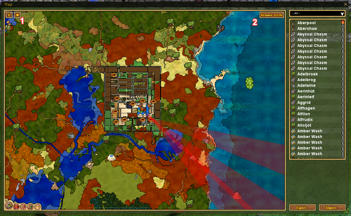
Tracking Display
- Display tracks on the minimap (also on the in-game map). Works with scents, rustroot elixirs, thingwall sense (see minimap section for more info).
- You can use this feature to triangulate the position of the scent source.
Quest Giver Tracking
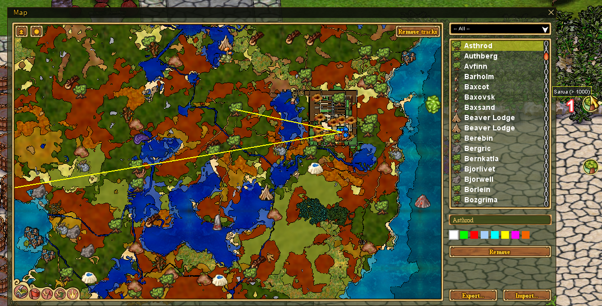
Alt + Right Clickover the quest giver icon [1] to add the yellow line to the map.- If the distance is too far (>1000 tiles), an endless beam will be added.
- You can use this feature to triangulate the position of the quest giver (you can add multiple beams for the same quest giver).
Remove Tracking Button [2]
- See tracking configuration in the minimap section. Also removes quest giver tracking.
Visited Areas Overlay
- The in-game map also displays the visited areas overlay when enabled (see minimap section for details).
- Areas you have visited (within object visibility range) will show a subtle white highlight.
- This helps identify which parts of your explored map still need to be checked for objects like quest givers or resources.
Survey Planner
A tool for planning terrain leveling projects by analyzing height data in a selected area.
How to use:
- Click the "Survey Planner" button in the map toolbox (right side panel)
- Click and drag on the map to select a rectangular area
- Release to see the survey results
Survey Info window displays:
- Area Size - Total number of tiles and dimensions (width × height)
- Min Height - Lowest point in the selection
- Max Height - Highest point in the selection
- Average Height - Mean height across all tiles
- Height Range - Difference between max and min
- Work to Flatten - Total height units that need to be moved to level everything to average
Notes:
- Selection must be within explored map areas
- The selection rectangle remains visible while the Survey Info window is open
- Starting a new selection or closing the window clears the previous selection
- Right-click cancels selection mode
Icon settings shortcut
- Hold
Shiftand click an icon on either the minimap or in-game map to open that icon's settings. - The map's Toggle markers action is configurable under
Options->Keybindingsand defaults toCtrl + M.